
So Many Wineries, So Little Time
Spend a night (or 2!) in wine country
There are too many wonderful wineries to visit in a day, let alone a weekend. But you can make the most of your time in Epic Wine Country by staying along the route connecting many of the wineries on the north shore of Lake Erie. There are several choices for accommodations including cottages and B&B's. This route is 60 km of pavement, but you can adjust it as needed to include your old (and new!) favourite wineries.
Wheatley Provincial Park Camping Overnighter
Day 1: to the park
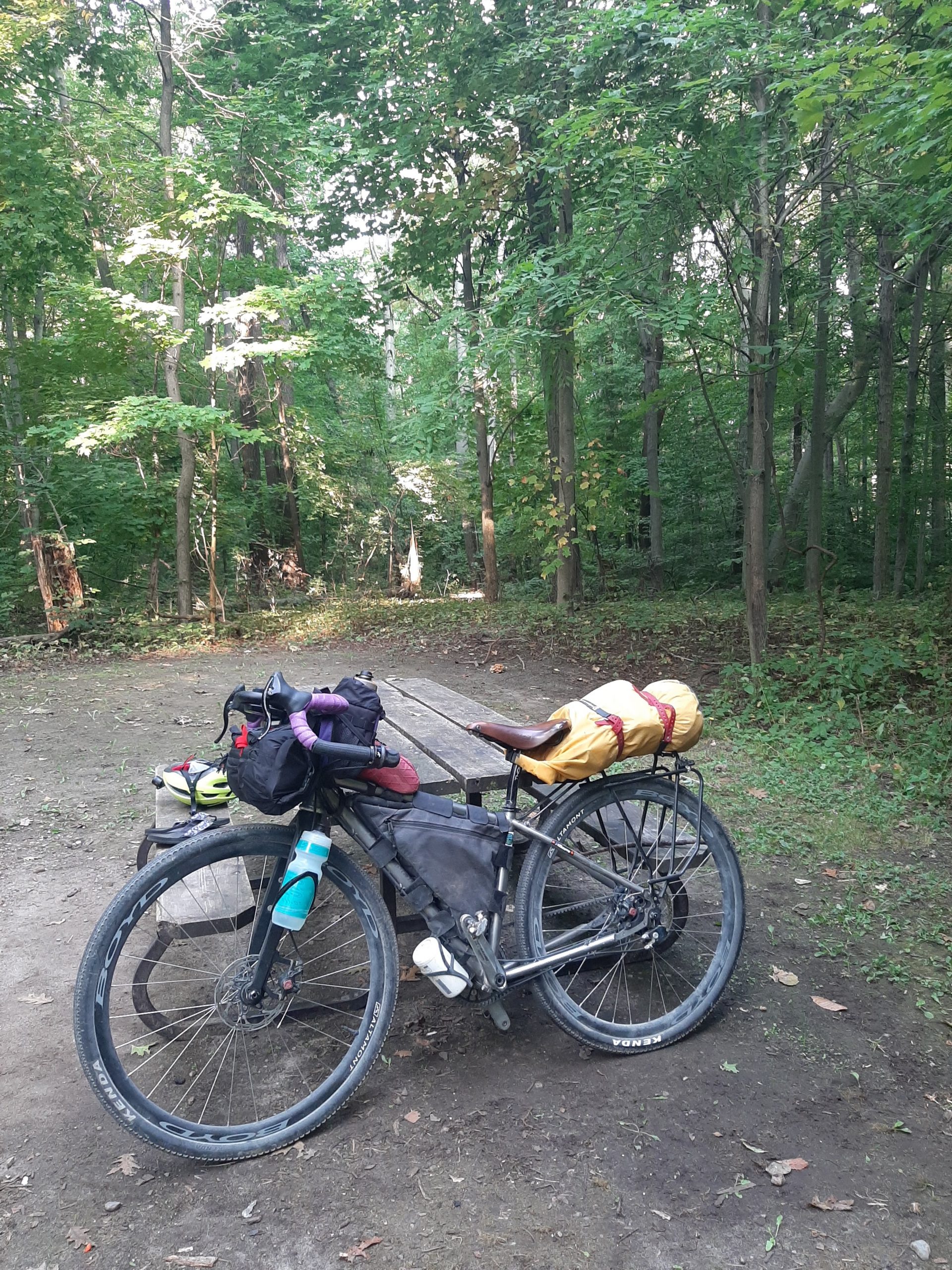
Pack your tent! A mixture of Greenway rail trail, streets with bike lanes and tar & chip roads lead you east and south of Kingsville. If you need any supplies, Leamington is essentially the last place to stock up on this 50 km route. The route passes the entrance to Point Pelee National Park, Hillman Marsh Conservation Area and the outskirts of the town of Wheatley. The Provincial Park has several camping areas, including a radio-free section. Take a refreshing dip in Lake Erie after setting up your tent and do some star gazing after supper.
wheatley provincial park camping overnighter
day 2: return to kingsville
The return 35 km trip takes a more northern route along country tar & chip roads. It does go through the outskirts of Leamington should you need to stop for refreshments. Rejoining the Greenway rail trail, enjoy the subtle downhill for the last 10 km of your overnight adventure.
Deep Southwest Ramble
Also posted on BIKEPACKING ONTARIO
This 218 mile/347 km bikepacking route consists mostly of gravel roads, with a small amount of pavement and a few sections of rail trail along the way. There are a few campgrounds near the route (reservations recommended for most of the season). Re-supply options in small towns are marked on the map. There are a few longer stretches without services, but with some planning, you shouldn't go hungry or thirsty. At least half a dozen craft breweries and at least as many wineries are either on or within a couple km of the route.
This map has the route starting in Ridgetown so it connects with a neigbouring route, but the figure 8 loop can be started in Kingsville, or anywhere else along the way.
Cycle Kingsville makes no representations, express or implied, as to the accuracy, completeness and timeliness of the information, maps, and data contained herein. Conclusions drawn or decisions made from the information provided on Cycle Kingsville.ca are the responsibility of the user. Cycle Kingsville.ca assumes no responsibility for the use of the information provided on this website.