
Guest post from Share the Road, Essex County

https://www.facebook.com/ShareTheRoadEssexCounty
We preface our feedback by acknowledging that, compared to a decade ago, the general knowledge that many decision-makers have today (regarding active transportation) has progressed by leaps & bounds. There is no reason to think this trend will not continue. We foresee a time in the near future when a guideline which proposes facilities that miss the mark will be easily challenged by a well and fully informed Council.
One general comment is that the draft proposals don’t mention or seem to consider e-Bikes (which is a user group that is exploding in popularity). The advent of E-bike (E-scooters) is a game-changer and we think it’s important that a Comprehensive Transportation Plan considers this fast-growing group of users.
DRAFT PROPOSALS WE ARE IN FAVOUR OF AND WHY
In terms of mileage, we are in favour of roughly 80% of the facilities proposed in Kingsville’s draft CTMP. Of the ones proposed, we favour the following the most.
Paved shoulders for McCain & Graham Side Roads, Rd 3 W and County Rd 34 (north of Hwy 3)

Motorists, farmers, pedestrians, ratepayers, cyclists (migrant workers and other rollers) and dogs will all benefit from paved shoulders.
Motorists. Having safer space, fewer cyclists will be in the main travel lane used by motorists. (The occasional sweeping will help ensure this benefit is maintained).
Farmers benefit from the extra width of paved shoulders which enables them to maneuver their wide farm equipment with ease. Cautionary note: On rural roads used by wide farm equipment and cyclists, if curbs are to be installed, they should be mountable curbs that do not inhibit maneuverability.
Pedestrians. Paved shoulders are a shared facility. Therefore, since there aren’t any sidewalks along these roads, pedestrians will benefit as well. (Being on both sides of the road, pedestrians can face traffic and avoid being startled from behind – which is the primary complaint pedestrians have about shared pathways & trails).
Ratepayers. Roads generally deteriorate first from the edges. By moving heavy traffic inwards and away from a road’s edge, paved shoulders can almost double the life span of a road and cut down on on-going maintenance costs and the frequency of future reconstruction. Over the long-term, paved shoulders provide all users a cost-positive benefit.
Cyclists (and other rollers). Presently, these road sections are a level 4(ii) cycling facility (as indicated on the chart farther below), because they can be stressed with motorized traffic which causes them to fall below the comfort level desired by most cyclists. The addition of paved shoulders will raise the comfort level to 3(i) and meet the comfort level desired by most cyclists. Consequently, these roads will go from being a NO-GO road to a DO-GO road for most cyclists. Each of these roads connects to the community and/or county AT network. This will open up many more great bike routing possibilities.

Bike Lanes on Division St S
We favour this proposal 100% but foresee the challenges it may have for future decision-makers to support and pass it.
The PROS are obvious for Cyclists (and other rollers). Bike lanes are a facility that’s dedicated to them. We also recognize that Division St S is presently the main cycling network connection between the lake, Lakeside Park, Greenway, and uptown. It can have significant truck and other traffic which justifies the need to have a safer cycling facility than one which is shared with parked automobiles.
On the other hand, the CONS are that the Funeral Home occasionally needs additional on-street parking. Some residences have also become accustomed to using the community road for their personal private parking.
In the interests of sharing and getting the support of future decision-makers, we would like to suggest an alternative proposal which is a fair compromise and easier to support, as a pilot project.

Flex bike lanes would blend the benefits of edge-lining (for parking) and bike lanes (to eliminate unnecessary parking) together. For example, on the same post, below the bike lane sign, another sign would be added that lists all the permitted exceptions, such as flagged automobiles (with funeral flags) and permitted vehicles (that have window stickers and licence plates on record with the Town). These latter vehicles would belong to those who have been granted special permission by the Town (as an exception) and who have also paid a parking fee for the special benefit which permits them to park their personal vehicle in flex bike lanes. This seems to be the fairest arrangement for all concerned on how to better share community property – especially on an arterial road that’s used and needed by many different users.
DRAFT PROPOSALS WE DO NOT FAVOUR AND WHY
When it comes to major capital projects, decision-makers should be guided to be wary of facilities surrounded by controversy, such as the following, and instead favour facilities that are being used and appreciated by many cyclists and other users today.
The proposed “Multi-use Paths” on Main St, Division St N and Union Ave (Ruthven)
Preface: These arterial roads are gateway routes into the centre and through the community. The first impression of how truly welcoming and accessible a community is, to all modes of transportation, is formed along these roads. These roads also provide numerous and important connections to the local and county-wide network.
The CONS for pedestrians on Main St and Division St N is that we/they would lose a perfectly functional pedestrian sidewalk for an inferior facility that’s shared with all cyclists. This is a big step backwards. Becoming a two-way facility, an additional CON of the proposed facility is the certainty that more pedestrians will be startled from behind.

The CONS for most cyclists are many. Without eliminating most of the driveways along Main St, Division St N and Union Ave (in Ruthven), a multi-use pathway will NOT be a safe and functional facility for All Ages & Abilities; in fact, for Most Ages & Abilities, in those locations, a multi-use pathway would be an unsafe and dysfunctional facility. The rationale for this is clearly explained on Page 40 of Ontario’s Cycling Skills guide.
These roadways in Kingsville simply intersect far too many driveways and streets. There’s a significant safety reason why cyclists are not supposed to ride on sidewalks – which goes beyond startling pedestrians or not giving walkers enough space. If the facility being proposed is not to be attached to the road (like a cycle track with mountable curbs), but instead is an in-boulevard pathway which bisects those driveways, we do not support it.
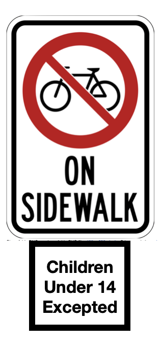
The CONS for children who bike. Kingsville’s by-laws permit children under the age of 14 year to bike on sidewalks. Bike lanes offer children who are capable and willing to ride in bike lanes another choice. Some children are perfectly comfortable and able to bike in lanes – especially if accompanied by their guardians. Children who prefer to bike on sidewalks will have the same additional annoyance that the proposed facility creates for pedestrians. Sidewalks should be retained intact (and added where needed) and not made multi-use because they provide an effective refuge for both pedestrians and young children who bike. A proposed facility that reduces Kingsville’s exceptional sidewalk network, should be rejected.

The CON for road cyclists / motorists relations is that some motorists will expect all cyclists to use an off-road facility that’s adjacent to a road – without understanding its safety and functional deficiencies. As a result, they will be less inclined to share the road respectfully with road cyclists. In this way, it makes riding on the road less safe.
Instead of an in-boulevard pathway, we would suggest paved shoulders or a cycle-track with mountable curbs along Union Ave (similar to the well-used and appreciated facility on CR20 (Seacliff Drive) east of Ruthven).
These would be safer and more functional than the facility proposed. Pedestrians, who presently do not even have a sidewalk, would gain a shared facility. Paved shoulders and cycle tracks are also facilities for both sides of the road. Being on both sides of the road, pedestrians can face traffic and avoid being startled from behind – which is the primary complaint pedestrians have about shared pathways & trails.
Most Ages and Abilities of cyclists will benefit from Bike lanes along Main St and Division St N. Bike lanes would be safer and more functional than the facility proposed. Pedestrians would keep their sidewalk – as would cyclists under the age of 14 years old.
These facilities check many more boxes than those proposed (4i below) in the draft CTMP – as illustrated on the following chart.
OTHER POINTS
The final version of the CTMP should include the following ideas.
Develop plans for easy, quick & ready solutions which can make more of existing assets. (For example, we think there’s enough width on Main St W to paint bike lanes between Queen and Chestnut St. This would highlight the way to bike and eliminate the most precarious low comfort gap section heading northwards between Lakeside Park and the uptown centre block.)
Adopt a policy to use mountable curbs instead of barrier curbs unless there are compelling reasons to do otherwise. Barrier curbs create a pedal-strike risk, reduce the space large farm equipment have to maneuver, prevent cyclists from exiting off a road quickly and forces more rainwater down storm drains – which can cause hydraulic load problems downstream.

Don’t use parallel stormwater grates that can endanger cyclists. https://ggwash.org/view/67323/see-some-stormwater-grates-that-could-endanger-cyclists-let-dc-water-know
The CTMP should guide decision-makers to prefer facilities that: i) provide the maximum benefit (in terms of safety and functionality) to the largest spectrum of cyclists possible; ii) also benefit other users; AND iii) do not diminish the existing benefit (safety and functionality) of other users. Guided towards these three objectives, decision-makers will ultimately prefer first rate multi-use facilities, followed by pedestrian sidewalks, bike lanes and paved shoulders, over multi-use in-boulevard facilities which intersect too many driveways and/or cross intersections too frequently (every intersecting driveway or roadway is a potential collision point). The latter should be understood as a fourth rate facility of last resort when there isn’t a better option.
Edge-lined roads helped kick-start Kingsville’s AT program and are still being used and appreciated by many cyclists today. They provide some refuge beyond the main traffic lane, help queue & calm traffic and are appreciated by pedestrians and other users – especially where sidewalks are missing such as along Remark Drive. They should be recognized as a valued AT asset, indicated on facility maps and maintained or improved to the recommended width of 1.3m.
Factor facilities for e-bikes into the plans.
First rate cycling facilities, which provide maximum safety and functionality, should be easy to find, recognize and navigate.

Roads designated as “signed bike routes” should be preferred routes and reach the level of comfort required by most cyclists. The placement of bike routes should be restricted and approved only after very careful consideration. This this regard, bike route signage should not be put on CR29 between Hwy 3 and CR34 as the draft CTMP proposes. A preferred way to ride between the paved shoulders between Division St N and CR34 would be along S. Talbot (Service) Rd. and Inman Side Road as shown on the map. Secondly, Emily Ave and Lakeview Ave and the pathway connecting them should be designated as a signed bike route.